

Celebrating 50 Years of Landsat
KBR’s Support to the World’s Most Critical Earth Observation Satellite Program Has Never Wavered
When natural disaster strikes, like the recent flooding in Pakistan, time is of the essence.
Known for both its readiness and technical expertise, KBR is tasked with supporting the Landsat Program – the very satellites used to help agencies with monitoring climate change, mapmaking and rescue efforts. These tools – humanity’s “eyes in the sky” – are not simply used for crises, but often for necessities like tracking crops and modern-day conveniences, such as Google Maps.
On July 23, 1972, the first ever Earth Resources Technology Satellite (ERTS-1), later renamed Landsat 1, was launched into space. For the past 50 years, Landsat – Earth’s most critical observation satellite program and its data archive – has offered civilization an important understanding and perspective of the globe unlike ever before.
The Landsat Program is a series of missions jointly managed by NASA and the U.S. Geological Survey (USGS). NASA builds and launches Landsat satellites and then turns them over to the USGS to operate. KBR supports this critical program through various contracts with both government organizations in four main ways: flight control, engineering, calibration/validation efforts and data management.
KBR and its team of experts have played integral roles in the Landsat Program for more than 20 years since the launch of Landsat 7 in 1999. A total of eight satellites have been launched throughout the past five decades, each evolving slightly with technological enhancements over time. These satellites track land use and document land change from 400 miles away to create a portrait of our planet used by billions of people worldwide.
Landsat 7 is currently the oldest satellite of the program still in operation. Since its 1999 launch, the KBR Landsat 7 Mission Operations Center and Flight Operations team has been flying Landsat 7 from mission control out of NASA Goddard Space Flight Center (GSFC) in Greenbelt, Maryland.
KBR also supports contracts such as NASA’s Omnibus Multidiscipline Engineering Services (OMES) II at GSFC, which supplied hardware and test support to the TIRS-1 thermal sensor on Landsat 8, launched in 2013, and the TIRS-2 thermal sensor on Landsat 9, launched eight years later in 2021.
With each new satellite, we can see more clearly than the last. The proposed successor to the current-generation Landsat 9 is Landsat Next, which is expected to launch later this decade. Landsat Next features improvements to provide even more detail, possibly with increased rotations around the Earth, improved resolution and more spectral bands.
Additionally, KBR has supported the USGS Earth Resources Observation and Science (EROS) Landsat program in Sioux Falls, South Dakota, since 2002. The KBR Technical Support Services Contract (TSSC) team provides operations and maintenance support for the Landsat archive and developed the Landsat 8 and Landsat 9 ground systems.
The TSSC team is involved in calibration/validation efforts that continually improve the quality of Landsat data, along with internal and external communications about Landsat. TSSC earth science-based application projects also provide crucial support to the National Land Cover Database (NLCD) and the Land Change Monitoring, Assessment, and Projection (LCMAP) program; fire management and firefighting data in the LANDFIRE (Landscape Fire and Resource Management Planning Tools) program; and evapotranspiration data that inform the WaterSMART (sustain and maintain America’s resources for tomorrow) initiative.
KBR’s support of the Landsat satellites includes maintaining an invaluable 50-year archive of data — more than 10 million scenes and counting. KBR employees have helped use that data to develop many types of tools for managing land, water, and wildfires that will only become more crucial as the climate continues to change.
“The KBR team is proud to have built a ground system that allows a diverse user community to access and utilize our Landsat data in multiple ways. Over 100 million Landsat scenes have been downloaded to date, and that number continues to grow. We have also seen increased access since releasing Collection 2 in the Amazon Web Service (AWS) cloud. We are excited to see all the benefits users can gain by performing data analysis directly in the cloud,” said Jessica Anderson, KBR/TSSC Landsat 9 Development Manager.
People around the world who manage and study the Earth’s natural resources have relied on Landsat to provide information about our food supply, the quantity of water used in irrigation, the quality and fluctuating sizes of our forests and water bodies, the growth and health-risk hotspots in urban areas, sudden and gradual changes in our glaciers and coastlines, the effects of natural disasters, and ground conditions for fire behavior models.
In addition to helping humans, KBR’s work on Landsat is also used to guide conservation decisions about wildlife habitat. Landsat helps with sustainability goals that range from a winemaker trying to irrigate with less water to a state government trying to achieve net-zero emissions.
On a national scale, LANDFIRE is a key data source for agencies utilized for the management of wildfires and plant materials that fuel fires, as well as planning for prescribed fires. Internationally, Landsat images are among the remote sensing images that feed into the International Charter Space and Major Disasters’ Hazard Data Distribution System, which is overseen by the EROS Center and operated by the KBR TSSC team.
Two key developments have been helping people use Landsat data more fully, including a 2008 policy that made the data freely available, as well as the development of cloud computing, which allows people to more quickly and efficiently process large amounts of data, making it easier to study change over time. The addition of the Landsat data to Google Earth Engine has made this type of research easier and forms the basis of the Google Earth 3D Timelapse tool.
Similarly, KBR employees helped with the effort to design, port and deploy the science data processing infrastructure for Landsat 1-9 into the AWS cloud platform. Scientists and other data users now have more than 10 petabytes of Level 1 and Level 2 science data products available in AWS.
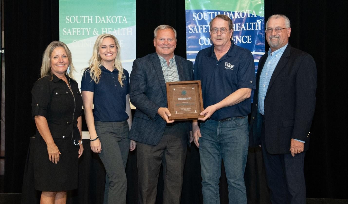
Through it all, EROS has consistently maintained a strong record of safety, and KBR has been awarded the top safety award by the South Dakota Safety Council for more than a dozen years, including its most recent award in 2021. It’s an honor to the employees and demonstrates their commitment to KBR’s Zero Harm 24/7 safety program.
“The TSSC safety team values its successful partnership with both the KBR Zero Harm Program and USGS EROS customer teams to continuously improve our operational processes and best practices to identify and eliminate the potential for safety issues,” said Brent Nelson, KBR/TSSC Zero Harm Safety Manager.
KBR employees at EROS were also among those on the Landsat calibration/validation team honored with NASA’s Robert H. Goddard Award in 2014, for Landsat 8 efforts, and in 2022, for Landsat 9 efforts. KBR’s team of experts work with USGS and NASA employees, as well as other partners, in preparation for the satellite launch, then work to calibrate and validate data before it can be released to the public.
With global warming and other natural hazards on the horizon, support for the next half-century of Landsat development is crucial. Fortunately, KBR is prepared to help weather the storm.